 |
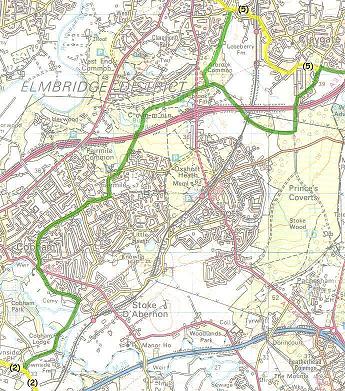
Downside to Cobham & Claygate via bridle paths |
|
Downside to Cobham & Claygate via bridle paths |
Downside to Cobham
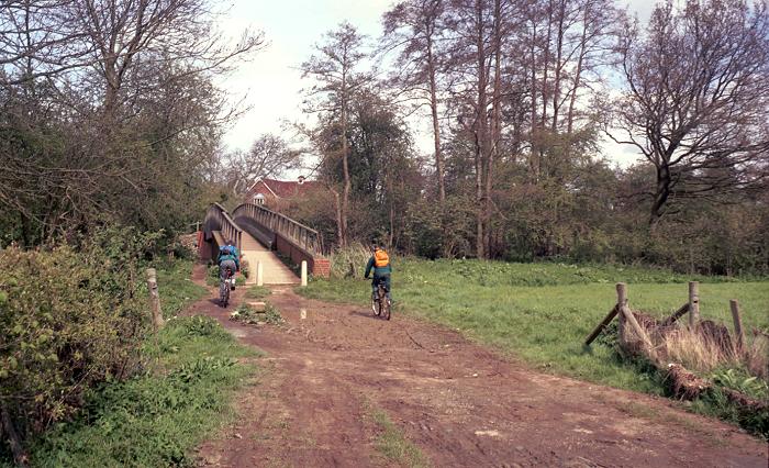
From Downside, leave route 2 at the southeast corner of the green and head north for 20 metres. Turn right after the tiny church along a bridle path across a field, turning right where the path joins the lane. In wet weather, you can take the longer but less muddy road route to the same point. Follow the lane until it curves right, and take the well-surfaced bridleway to the left. This leads over the River Mole, and join a minor road in Cobham. Turn right for Cobham station, otherwise turn left to a junction with the main road (2.2km, 1.4M).
 |
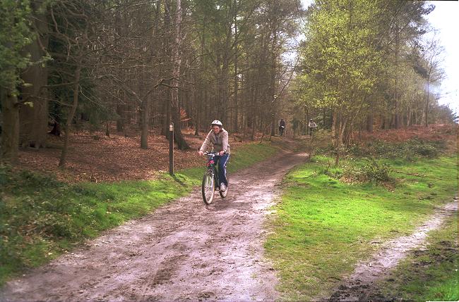 |
| A well-surfaced bridleway leads to a brodge over the River Mole to Cobham. | Fairmile Common provides pleasant wooded bridle paths between Cobham and Esher. |
Cobham to Esher and Claygate
Cross the main road and use the map to navigate through the residential roads to join the bridleway on Fairmile Common. Cross the bridge over the A3 bypass road, and follow the pylons to cross the Esher - Leatherhead road onto Arbrook Common. A bridleway to the left after 100 meters leads to Esher (6.6km, 4.1M) and western Claygate via route 5. Otherwise, follow the bridleway under the bypass and railway, and turn left at a T-junction to recross the bypass. Fork right, follow a bridleway through a wood, and join route 5 (7.7km, 4.8M) for Chessington.
Diagram of Route
Last updated 28/03/01